![An Australian Government Initiative [logo]](/images/austgovt_brown_90px.gif)

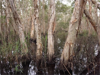 Paperbark Melaleuca swamp near Bundaberg, Qld |
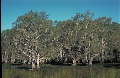 Melaleuca forest forming paperbark swamp, Melaleuca quinquenervia, near Bellingen, NSW |
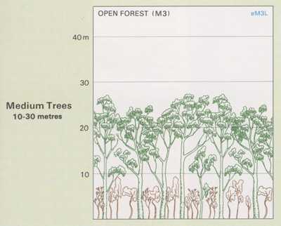
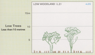
Foliage cover of tallest stratum 30 - 70% |
Melaleuca Forests and Woodlands
- Vegetation types dominated by the paperbarks
(Melaleuca spp.) cover substantial areas in the
tropical north but are also found in temperate
climates most often in or adjoining coastal
or montane wetlands.
- Monsoonal melaleuca woodlands are
dominated by the broad-leaved Melaleuca
viridiflora (paperbark), M. leucadendra (weeping paperbark), M. argentea (silver
paperbark), M. dealbata (blue paperbark)
and/or M. nervosa (yellow-barked paperbark).
They are found in the Northern Territory and
in Queensland adjacent to the Gulf
of Carpentaria.
- In southern and eastern Australia the melaleucas are confined largely to the wetter watercourses and swamps with M. quinquenervia being the most widespread coastal species.
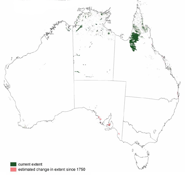
The Melaleuca Forests and Woodlands have been extensively cleared on coastal floodplain areas for agriculture or housing near major cities. Extensive areas remain in the tropical north, in particular southern Cape York Peninsula.
![]() Photos from the Australian Plant Image Index
Photos from the Australian Plant Image Index
Sources: Australia's Native Vegetation - from rainforest to spinifex, map and information poster produced by the National Land & Water Audit, Natural Heritage Trust, Australian Government, 2001
Australia's Native Vegetation - A summary of Australia's Major Vegetation Groups, 2007, Australian Government website
https://www.environment.gov.au/system/files/resources/a9897cf2-9d38-4201-bea2-13dadf3af9a8/files/major-veg-summary.pdf
Structure diagram: Atlas of Australian Resources - Vol. 6, Vegetation, AUSLIG, Canberra, 1990