![An Australian Government Initiative [logo]](/images/austgovt_brown_90px.gif)

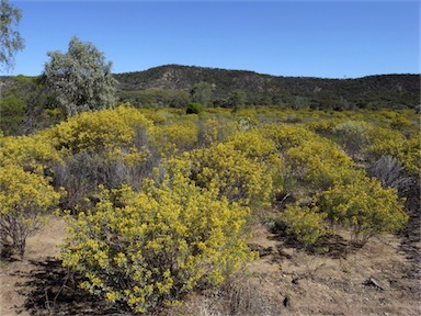
 Shrubland dominated by Eremophila polyclada (in flower) and grassy understorey, Burke, NSW |
 Senna shrubland, Idalia National Park, Qld |
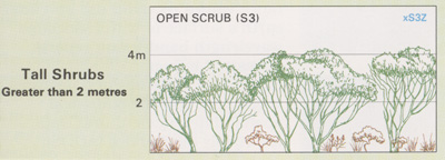
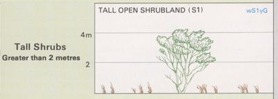
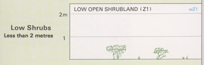
Foliage cover of tallest stratum 30 - 70% |
Other Shrublands
- Dominated by a broad range of shrub species
and may include mixed species communities
and mosaics of several communities. These
communities do not fit well in other
shrubland vegetation.
- Contain a range of genera including Banksia, Bursaria, Dodonaea, Eremophila, Grevillea, Kunzea, Leucopogon, Muehlenbeckia, Neofabricia, Nitraria, Persoonia, Senna, Thryptomene, Allocasuarina, Casuarina and Melaleuca.
These shrublands have been extensively cleared in the agricultural regions and in coastal areas adjoining major cities. In the arid zone, little has been cleared but many areas have been impacted by grazing pressure from domestic stock, feral animals and macropods.
![]() Photos from the Australian Plant Image Index
Photos from the Australian Plant Image Index
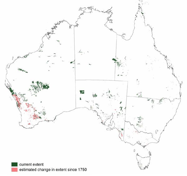
Sources: Australia's Native Vegetation - from rainforest to spinifex, map and information poster produced by the National Land & Water Audit, Natural Heritage Trust, Australian Government, 2001
Map: Australia's Native Vegetation - A summary of Australia's Major Vegetation Groups, 2007, Australian Government website
https://www.environment.gov.au/system/files/resources/a9897cf2-9d38-4201-bea2-13dadf3af9a8/files/major-veg-summary.pdf
Structure diagram: Atlas of Australian Resources - Vol. 6, Vegetation,
AUSLIG, Canberra, 1990